SA - Eyre Peninsula
- Ken Fredric
- Mar 1
- 16 min read

Updated: Mar 6
Day 13 - Quorn - Murninnie Beach SA, 22 February, 2026
Our intention today was to see the sights of Quorn then carry on south.

However, rain started falling during the night and wasn't showing any signs of stopping, so we just started driving towards Port Augusta in the heavy rain.
In Port Augusta it was straight to the supermarket and bottle shop to stock up on our dwindling dry and wet supplies, and to fill up with diesel.
Next up we drove to Point Lowly to check out a campground and to have lunch.
It was still early so we continued on for another 90 km to a free camp on Murninnie Beach, stopping at the Whyalla information centre on the way.
Because it was quite windy outside, and while currently not raining there were a lot of grey clouds around, we didn't bother setting up outside.
Day 14 - Murninnie Beach - Cleve SA, 23 February, 2026

Leaving our windswept beachfront campsite this morning we headed for our first destination of the day, the seaside town of Cowell.
On the outskirts of town we stopped at the silo art installation for a couple of pic's.
In town I went to the pharmacy for one of my regular scripts but the pharmacist wasn't on duty until 1:00 p.m.
I then called Harvey Norman in Port Lincoln, where we would be in a few days, to see if they could supply me with a new laptop of my choice. They said they would be able to, so I ordered one online using click and collect.

Meg was amused when she went to the public toilet and was greeted with some ‘crap art’, various artworks done by random people.
We then drove a short distance to the boat harbour/jetty. We intended to walk out to the end of the jetty, but there was a cold wind blowing that changed our minds. We were lucky enough though to see a dolphin swimming around the harbour a few metres from us.
Next up was a drive to Cleve, another small town that was in the wheatbelt of SA.

On the way we stopped at a memorial to May Gibbs, the creator of the Gumnut Babies books.
In Cleve, after taking my script to the pharmacy, we drove around town to see the impressive metal sculptures, mostly of Clydesdale horses, and some wall art.
Back at the pharmacy I asked the pharmacist to have a look at what seemed to be a stye in my right eye. She suggested I should see a doctor.
Looking around town at more sculptures I noticed a doctor's surgery so went in on the off chance of getting an appointment during the day. I managed to get one at 2:15 p.m. which meant we had a couple of hours to kill.

It wasn't far from lunchtime so we drove up to a nearby lookout and had lunch.
There was a scenic drive nearby that seemed like a good way to waste some more time, so that's what we did. Not far off the scenic drive there was also a wind farm that we visited to use up more time.
Back in Cleve I went to the doctor who gave me a script for antibiotics, which meant another visit to the pharmacy.
The last drive for the day was to the free camp at Yeldulknie Weir 5 km out of town where we set up for the night.
Day 15 - Cleve - Cowleys Beach SA, 24 February, 2026

Continuing on our exploration of the Eyre Peninsula, we left our quiet campground, and drove back into Cleve where we turned off towards Arno Bay.
The drive was mostly boring, travelling through thousands of hectares of grain farms until we reached Arno Bay.
Our first stop was at a small lookout that had views of the boat harbour, the bay and out to sea.
Next up was a walk around a boardwalk trail that took us through mangrove swamps and dry sandy areas with an interesting array of flora.
That was all Arno Bay had to offer us so we continued on travelling south west to Port Neill.
It was smoko time by then, which we had up at the town's lookout that had great views of the bay and surrounding areas.

Back down the hill we pulled up at a park opposite the pub to fill up with fresh water.
After a drive around the town we continued along the coast road looking for a free campsite for the night.
The first site we came to didn't look appealing, so we continued on the rough unsealed road for another 10 km to Cowleys Beach.
We had a walk on the beach first but, because it was so windy, we didn't loiter or bother setting up outside.
The rest of the day was spent relaxing and catching up with travel plans, blogging and socials.
Day 16 - Cowleys Beach - Tumby Bay SA, 25 February, 2026

We only had a short drive today to the next seaside town on the peninsula, Tumby Bay.
Our first stop in town was the information bay to read up on the history of the town, and to get a map of the town's wall art trail.
We parked up near the waterfront and set out walking around the streets to look at most of the wall art, most of which was very colourful and impressive.
The day was quite cool, with a very strong wind coming off the sea, so we cut the walking tour short and drove around the rest of the wall art sites, including driving out to their silo art installation a little way out of town.

Back in town we checked out a couple of potential campgrounds and decided on the small CWA-run camp that was close to the shops.
Having skipped brekky we were getting hungry and went to the nearby bakery for a pie and coffee.
It was still early in the day but we were able to set up on our campsite, chill for a while, then went for a short walk to see some wall art we'd missed earlier.
During the walk we spied a laundromat, having thought there wasn't one in town, so the next job was to do a load of washing.
That was enough excitement for one day and we relaxed for the rest of the day.
Day 17 - Tumby Bay - Surfleet Cove SA, 26 February, 2026

Our primary goals for today were to drive to Port Lincoln, take the old laptop to a computer repair shop to recover some data off the hard drive, and to replace some things that had recently broken.
It was only a short drive to Port Lincoln and the first stop was at a computer repair place that said they could do the data recovery that day.
After filling up with diesel we called into BCF to buy a new hoodie and thongs for Meg, and a new footstool for me.

With the chores done we drove back into town and parked up on the waterfront.
Walking along the waterfront we took pic's of the Makybe Diva statue and the Tuna Poler statue before heading into the information centre.
At that stage we hadn't decided where to spend the night. After chatting to the helpful lady there we decided to go into the Lincoln NP and stay at one of the campgrounds there. We chose a campground, paid up then discussed what to do for the rest of the day.

We drove up to a lookout, had lunch then thought we may as well go into the national park and see what there is to see before stopping for the night.
The drive to our campground was all on good sealed roads but, because it was still early, we would carry on to the end of the road where there was a lighthouse.
That was 11 km of badly corrugated unsealed road that took us about 30 minutes to cover. The lighthouse and nearby beach were unremarkable so after taking a couple of photos we turned around and drove back to the Surfleet Cove campground.
We had a stroll along the beach first then got set up for the night.
Day 18 - Surfleet Cove - Whalers Way SA, 27 February, 2026

Our first job today was to pick up my old laptop in Port Lincoln that the computer company had recovered data off.
Then it was back to the information centre to buy a pass for the Whalers Way drive, which we intended to do after lunch.
Our planned lunch was going to be fresh seafood from one of the many seafood sellers/restaurants in town.
Because it was too early for lunch, we drove out to the lookout past the marina for some great views of the sheltered bay, back towards town and out to sea.

Then, after a slow drive to our chosen seafood restaurant, it was near enough to lunchtime for us to eat. We both enjoyed our respective meals of fish and chips and a seafood basket, with the fresh fish making all the difference.
Our next adventure was the Whalers Way self-drive tour that runs around the coast to the south of Port Lincoln, where the whaling industry was located in the 1800s.
Once on Whalers Way proper, which is located on private land, the road was unsealed and quite rough in places.

There are dozens of points of interest, historical sites and amazing lookouts along the way, many within a few hundred metres of each other. The road rises to over one hundred metres at its highest point, so the views were spectacular.
Stopping off at Cape Wiles we hoped to see some fur seals, but were disappointed. Sadly that was also the case at Osprey Nest where we couldn't see the nest that has been there for over 30 years.
By the time we got to the sinkhole we felt like we'd done enough for the day and drove into a nearby rough bush camp for the night.
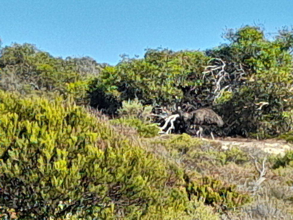
As we drove into the campsite a very large Emu appeared out of the bush in front of us, then retreated upon spotting us. After parking up we realised the Emu was probably heading for the water trough beside the campsite, so we felt a bit guilty about that.
I had a phone call during the afternoon to say that my new laptop had arrived.
Day 19 - Whalers Way - Coffin Bay NP SA, 28 February, 2026

After a beautiful day the day before, we woke to light rain this morning, which had started sometime during the night.
We had planned to continue our exploration of Whalers Way this morning but, considering the weather and lack of visibility, that would have been a waste of time.
We continued on a little way though to a lookout that boasted views of the oldest rock in SA, over 3 billion years old.
Deciding that was enough exploring for a wet day, we turned around and drove back to Port Lincoln.
After visiting the dump point and filling up with water we drove to Harvey Norman to pick up the laptop, and popped into the adjacent BCF for a couple of things.

Then, after picking up some shopping, we headed out of town towards Coffin Bay.
It was only a short drive and we arrived in Coffin Bay before lunch, after stopping off at the lookout on the outskirts of town.
We parked up near the town's boat ramp for lunch, before continuing on into the National Park.
Twice on the drive into the park we got stuck behind Emus walking down the road and it took some time to get past them.
It was still raining after we got settled so we stayed inside for the afternoon.
Day 20 - Coffin Bay NP - Nyroca Scout Camp SA, 01 March, 2026

We woke to heavy fog this morning, which put paid to our plans to see some of the more iconic beaches and views around the national park.
We did drive out to Point Avoid, mostly because we liked the name, but because of the fog there wasn’t much of a view past a couple of hundred metres.
I really wanted to see Almonta beach because I’d been told it was one of the most beautiful beaches in the world but, once again because of the heavy fog, we gave that detour a miss.
The drive back into Coffin Bay was quite slow because visibility was down to about 100 metres in some places.

In Coffin Bay we visited the dump point then went to the local IGA for a few supplies, before heading out of town, bound for Dutton Bay to see an historic shearing shed and jetty.
When we arrived there we discovered that the shearing shed was closed, and that it was too cold to walk far out the jetty.
We were initially headed to Coulta for the night, but decided that because our power level was quite low that we should find a powered campsite for the night.
That meant driving for a few more kilometres to the Nyroca scout camp, where we setup and plugged into the 240v for the night, and spent the rest of the day trying to catch up with the blogging with the new laptop.
Day 21 - Nyroca Scout Camp - Elliston SA, 02 March, 2026

After more overnight rain, we woke to a dull overcast sky and cool temperatures.
Our destination for the day was Elliston, about 120 km away, with some side trips along the way.
The road took us close to the coast for most of the way, and our first detour was to Point Drummond, about 12 km off the Flinders Highway. There were some impressive lookouts along the way with views of towering cliffs and wild seas crashing onto rocks and beaches.

There was an information board at the point that told the story of a couple of 15-year old sailors in the 1800s who jumped ship and were eventually caught and jailed. The views were just as impressive at the point itself.
Back out on the main road, we continued on until we reached the Cummings Memorial Lookout, where there was a memorial to a cray fisherman who had drowned a few decades ago. Once again we were treated to spectacular cliff and ocean views.
A little way further along the main road we stopped at the Eating House, an eating house that was built in the 1850s to serve travellers passing through the area.

While driving we had noticed many old dry stone walls that had been used as fences by the early settlers. While most were almost derelict, on example that we stopped at was still largely intact.
Our next stop was the information centre in Elliston, where we planned to stay the night. We had lunch while stopped, then drove around the town looking at some old buildings and the jetty before setting out on the Clifftop Art and Sculpture Tour.
The tour took us around the headlands not far out of Elliston, past many art installations and more magnificent coastal views.

An example of the art installations, the first one we came to, was a large pair of wooden thongs, sitting upright on the heels, that were taller than me. Another example was a set of three Easter Island heads overlooking a dramatic bay surrounded by sheer cliffs.
With the tour completed, all that remained to do for the day was to find somewhere to camp for the night. We decided on the local golf club that offered a gravel car park, up a hill with views out to the ocean for $10 for the night.
We couldn't orient ourselves as we normally would, so didn't have enough shade or protection from the wind, so we stayed inside for the remainder of the day.
Day 22 - Elliston - Streaky Bay SA, 03 March, 2026

We continued on our journey today towards the westernmost point we would travel to on this trip, Streaky Bay. From there we would start heading inland and eastwards back towards Port Augusta.
Our first stop of the day took us 6 km down a badly corrugated unsealed road, that had us travelling at only 20 km/h for most of that distance, to Woolshed Cave. This was a spectacular piece of coastline, with tall cliffs, red-coloured rocks and crashing waves.

From the car park there was a set of steps that took us down to nearer sea level and, after scrambling over some rocks we came to the cave that the area is named after. We'd also read that there was a 'nature's window/' rock formation nearby but, after climbing over some more rocks to find it we had to retreat after the waves started crashing up onto the rocks in front of us.
Further around the coast there was a memorial to a nun who had died in 1928 when she stood on the cliff's edge to take photos and the cliff edge collapsed. There were more stunning views from those cliffs.

Back towards Woolshed Cave there was another feature called The Tub, which was a huge crater in the cliffs that had obviously collapsed at some point in the past, and was still open at one point to the sea.
Back on the road we carried on to Venus Bay, one of the nicest bays we'd come across so far. The first stop was a lookout with more stunning views of cliffs and big seas, and that also had an 'eye of the needle' rock formation in the cliffs.

Not far from the lookout we drove to the South Head Walking Trail car park and set out on the 2.2 km walk, that offered promise of seeing fossils and dolphins. While the walk offered amazing views and a great array of flora, we didn't see any fossils or dolphins.
Then it was a short drive to a car park overlooking the wharf area where we stopped for an inhouse lunch.
Our last stop for the day before Streaky Bay was the Murphys Haystacks rock formations located at Mortana. Murphy's Haystacks are inselberg rock formations. They are a tumulus form of weathered granite outcrop.
In Streaky Bay we stocked up on some supplies before going to the showground campground for the night.
Day 23 - Streaky Bay - Gawler Ranges NP SA, 04 March, 2026

To start off what would be our last day exploring the Eyre Peninsula coastline, we first had to do a few chores.
In Streaky Bay we filled up with diesel, visited the dump point and filled up with fresh water.
We chose one of the scenic drives not far from town to finish off our coastal odyssey, the Cape Bauer drive.
The first stop was at the whistling rocks and blowhole, accessed by a boardwalk down to the cliff's edge. Unfortunately the tide was too low to be able to fully appreciate these natural features, but we could still hear waves going up into the blowhole. After that we only stopped at the Cape Bauer Lookout, for more views of the coastline and Olive Island, which is home to a seal colony.

The last part of the scenic drive took us back into Streaky Bay, then we headed out of town towards the Gawler Ranges NP, where we planned to stay the night.
After lunching in Minnipa we drove towards the NP, but carried on past the turnoff to see Pildappa Rock. In a mostly flat, barren landscape where you feel you can see all the way to WA, the rock really stood out. We started out walking around the rock, then found a path that took us over and up to the highest point before returning to ground level.

We had considered camping the night there, but the files were really bad and it was still early in the afternoon, so we started the drive into the park where there were more campgrounds.
At the entrance to the NP we stopped to read the information boards, then decided we'd like to see the Organ Pipes, a rock formation that looks like, well, organ pipes! The pipes were 10 km up a side road that we were a bit wary of because of the condition of the 'main' unsealed road we'd been on for some time.
We were right to be wary of the road condition, that required 4WD and some teamwork at times, with Meg having to get out and help me navigate around bad washouts that contained very slippery mud after recent rains.

Once at the carpark, we still had a 400 metre walk on a rough, rocky track to get to the organ pipes which, after having seen Sawn Rocks in NSW, were very underwhelming, leaving us to wonder about our crazy plan to go there.
Back out to the 'main' road, and another 3 km further on, we came to our campsite for the night at the Yandinga campground.
After setting up and cranking up the Starlink, we were doing our usuals when I had a phone call from a lady at Parks SA to let us know that the park was actually closed because of bad road conditions from the recent rains. She then decided that the park was opened today, but only to 4WDs. We then confirmed that we would leave the park the next day, taking the shortest route out, which was the way we had come in.
Day 24 - Gawler Ranges NP - Kimba SA, 05 March, 2026
After having to change our plans because of the NP closures, we decided to start heading back towards Port Augusta, with a destination of Kimba for a night's stay on the way.

Our first challenge was to get back out onto good roads, and off the chewed up park roads, which meant retracing our steps from the day before as far as Minnipa.
We achieved that without incident, stopping in Minnipa for morning tea before carrying on east to Kimba.
It was quite a boring drive, passing by thousands more hectares of grain paddocks on the way.
After we got setup in the free RV campground in Kimba and had some lunch, I wandered down to the shops for a few supplies, then chilled for the rest of the day.
Day 25 - Kimba - Port Augusta SA, 06 March, 2026

For today we had initially considered driving a short distance to the Gilles Conservation Park to spend the night there, but then thought it would be better to carry on to Port Augusta, before heading south to the Yorke Peninsula and Kangaroo Island.
This was another fairly boring 150 km drive, passing more grain farms, along mostly dead straight roads for kilometres on end.
In Port Augusta our first stop was at Bunnings for a couple of things to keep the motorhome running smoothly.
Our one nod to touristing here was to visit the Australian Arid Lands Botanic Gardens. At the Matthew Flinders Lookout we had a short walk to a lookout of some red cliffs and of the Spencer Gulf, where Flinders had landed in 1802. We had intended to walk further but the temperature was rising and the flies were rabid.

We then had a look around the visitor centre before having a wander through some of the gardens.
In town we stocked up on wet supplies, as much as we could anyway with their stupid restrictions limiting sales of wine casks to one per person, which includes having to show your driver's licence.
After setting up at the Stirling North campground we got a load of washing on, had lunch and relaxed for the rest of the day.


Comments