NW Qld

Updated: Oct 5
Day 01 - Howard - Lake Victoria, Goovigen, 02 September, 2026
On the first day of this adventure to Lawn Hill NP, NW QLD, we had planned to only drive as far as Calliope, about 280 km north.

As with many of our plans though, they are very flexible.
After leaving home around 8:30 A.M. and heading up the Bruce Highway, we stopped in at Gin Gin for a couple of things from the supermarket and to fuel up with the cheapest diesel around, which was still $2.45 per litre.
The plan then was to carry on up the Bruce to Calliope and to stay there for the night. However, it was annoying having to regularly pull over to let vehicles go past us, as we were only travelling at 80 km/h, so we made the decision to hit the back roads.

Somewhere between Gin Gin and Miriam Vale we turned off onto Kalpowar road, which started off sealed but then turned to unsealed very shortly after. The road was in reasonable condition though, so we made fairly good time to Kalpowar, where we stopped in the sleepy little town for lunch.
Carrying on our journey north-west we passed through a number of small towns, including Monto and Biloela, towns we'd explored on previous adventures.

Arriving at our destination for the night around 2:30 P.M., Lake Victoria near Goovigen, we set up beside the lake and set about identifying the myriad species of birdlife, that included White Egrets, Kookaburras, Geese and many others.
As it was a pleasant 28 degrees, we enjoyed sitting outside with a drink catching up with socials and birdwatching, after the 350 km drive.
Later in the afternoon we had a visit from a large white goose that looked scary, but was only scrounging for food from us.
At twilight we were treated to a spectacular sunset, which capped off a great camping spot.
Day 02 - Lake Victoria, Goovigen - Bluff Hotel, 03 September, 2026
With only about 160 km to drive today, to Bluff, we were in no hurry to leave our beautiful campsite.

The birdlife was just as impressive in the morning as it had been the day before, and we went for a short walk to try and identify some more of the birds. One very strange bird call puzzled us, never having heard it before, until we spotted that a couple of Kookaburras were responsible for it.
Our drive started out on the Leichhardt Highway, before we joined the Capricorn Highway. Both roads being fairly busy, with a lot of trucks, meant we couldn't potter along as much as we wanted to for most of the journey.
We stopped off in the small town of Dululu to empty the toilet cassette, before continuing on to Duaringa where we pulled in to fill up with fresh water and to visit the information centre.
Starting to feel hungry, and with the road getting busier, we sped up to avoid holding up other traffic, and to get to Bluff sooner for lunch.
At the Bluff Hotel we checked in to stay on an unpowered site behind the pub for the night, then ordered drinks and lunch. The food was standard pub fare, which we cleaned up in no time from being so hungry.
With lunch out of the way we got setup for the night and sat outside for the afternoon, enjoying the high 20s temperatures with a gentle breeze.
Day 03 - Bluff Hotel - Lara Wetlands, 04 September, 2026

With over 400 km to drive for the day, we were up and about and on the road a bit earlier this morning.
Our first stop was past Blackwater, where there was an installation of metal Minion sculptures, opposite a rest stop, in the middle of nowhere! Who knows why?
Next up was a shopping expedition to Woolies in Emerald to pick up some salad items, considering the temperatures were getting into the 30s.
Not far out of Emerald we stopped to get a photo of the Big Sapphire in Anakie Siding, then carried on to Alpha, where we stopped for lunch.

After lunch we went for a short walk to look at the town's Brolga statues, wall art and cow sculptures.
At Jericho, we turned off onto a minor road to avoid having to go into Barcaldine, which unfortunately was unsealed and quite rough to start with. We resigned ourselves to having a a slow drive for the last 60 km of the journey, but luckily the road condition improved allowing us to cover that section in reasonable time.
That brought us out onto the Landsborough Highway for a short distance, then onto the Lara Wetlands road, which was in quite bad condition too.

At Lara Station Wetlands we checked in for two nights and found a campsite looking out onto the lake.
The temperature had risen to 35 degrees during the day so, after setting up, we thought we'd cool off in the small dam adjacent to our site. The idea was great, but the water temp wasn't up to our 30 degree standard, or anywhere near it for that matter, so it was a quick dip only.
We sat outside for the rest of the afternoon enjoying the beautiful surroundings and large range of diverse birdlife.
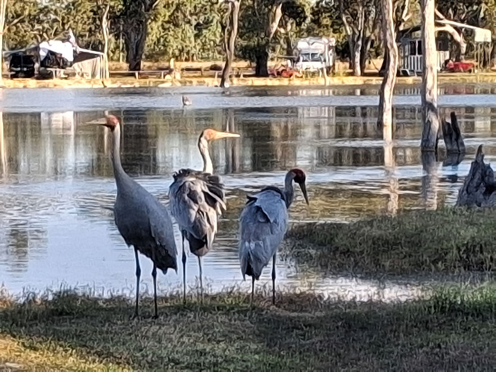
A family of ducks, mum and dad and two ducklings came past our campsite at one point, then a family of Brolgas, mum and dad and a young one, did the same.
The temperature inside Mata late afternoon/early evening was over 30 degrees, so we stayed outside until well after dark, taking in the night sky from a different aspect than we would normally see.
Day 04 - Lara Wetlands, 05 September, 2026
Today was largely a chill day, to enjoy the wonderful surroundings of the wetlands.
As soon as we got up we went to have a dip in the hot pools, which would be much too hot later in the day.
After the hot pools and breakfast we went for a walk right around the wetlands, meeting up with another Explorer owner, Bronwyn from Victoria, who was travelling in a Pathfinder numbered in the 700s.
Apart from a quick clean to remove some of the dust from inside Mata, we spent the rest of the day relaxing outside keeping an eye on the birdlife to try and identify more species.
Day 05 - Lara Wetlands - Free Camp, Corfield, 06 September, 2026

After an idyllic couple of days at Lara Wetlands, today was back to being a driving day.
And, once again, we would be passing through towns that we'd explored on previous trips, like Longreach and Winton so we didn't have any touristing scheduled.
The first part of the drive took us back on the Landsborough Highway, to Longreach.
We stopped in Longreach to top up our fresh water, grab a couple of things from the supermarket and to have lunch.
Next up was a 175 km drive to Winton.

That part of the drive was very boring with a flat and featureless landscape, brown farm paddocks, no animals to speak of and 37 degrees outside.
In Winton our only stop was to partially top up the diesel, at $2.75 per litre, buying just enough to get us to Cloncurry where the price was 20c per litre cheaper (thanks Petrol Spy app). With the next fill being over 100 litres, that would be a saving of at least $20.
The last drive for the day was to an isolated free camp about 50 km north of Winton. Once off the highway, the drive into the camping area was quite rough, but not too long.
We found a semi-shady spot well away from the one other RV camping there, got setup and sat outside to catch whatever breeze we could to dampen the 36 degrees temperature.
The star show was brilliant later on after dark, in a zero-light dark sky area.
Day 06 - Corfield - McKinlay, 07 September, 2026

After a very quiet night, with only the one other vehicle a few hundred metres away, and being well away from any roads, we were well rested to start the day.
Only having 175 km to drive for the day, we took our time with the morning routine and didn't break camp until 9:00 A.M. Although still early in the day, the temperature was 30 degrees as we left camp.
The drive was similar to the previous day, passing through boring, flat, featureless landscapes, with only a few small rock formations to break the boredom. We did see a few Emus but, apart from that, cattle were the only animals we saw.
The only town we passed through was Kynuna, which had nothing to offer, so there was nothing touristy to see or do along the way.

We arrived at our destination of McKinlay around lunchtime.
McKinlay is of course the site of the famous Walkabout Creek Hotel, of Crocodile Dundee fame. We were familiar with the pub because we had stayed behind the pub on a previous trip through the area.
We got setup on an unpowered site, then went into the pub for lunch and a welcome cool beer, as it was 35 degrees when we stopped at the hotel.
We spent the afternoon trying to hide from the sun and find as much shade as possible, while relaxing for the rest of the day.
Day 07 - McKinlay - Mary Kathleen, 08 September, 2026
This was to be another short driving day, about 175 km, to Mary Kathleen.
Leaving McKinlay the landscape was similar to the previous few days, i.e. pretty boring. However, that changed quite quickly as the vegetation increased and as rocky hills began appearing. Further into the drive we were completely surrounded by the hills and vegetation.

Stopping in Cloncurry, we filled up with cheapest diesel around, $2.50 per litre, popped into the hardware store for a couple of items, grabbed a few things from the supermarket and stocked up on booze, as we were heading into unknown territory in the next couple of days.
From there it was a short drive to Mary Kathleen, where our campsite for the night was at the abandoned uranium mine town, where we had stayed previously when passing through the area.
After setting up and having lunch we chilled outside for the afternoon, enjoying the breeze and slightly cooler temperature than the previous few days.
Day 08 - Mary Kathleen - Camooweal Billabong, 09 September, 2026

Leaving Mary Kathleen this morning, it was back out onto the A2 highway to Mt Isa, where we had a few chores to do.
First up was a stop at Woolies to stock up on a few supplies, then a trip out to BOC to get our gas bottle refilled, only to be told they don't do it and we should go to BCF. BCF did fill up the bottle, then we went to a bakery for some morning tea, but they only had cakes and sticky buns, so it was back across the road to Woolies for some cheesymite scrolls.

The last stop was to a dump point to empty the toilet cassette, then back to the highway for the drive to Camooweal.
We stopped at a rest stop to have an early lunch, before continuing on to Camooweal where we topped up with diesel, at $2.87 per litre.
The last stop for the day was just out of town at the Camooweal Billabong, where we got setup for a three-night stay.
The billabong was teeming with birdlife that included Egrets, Herons, Pelicans, Cormorants, Jabiru, Brolgas and many varieties of ducks.
The temperature was persistent at 36 degrees, so we spent the afternoon outside to catch any available breeze.
Day 09 - Camooweal Billabong, 10 September, 2026
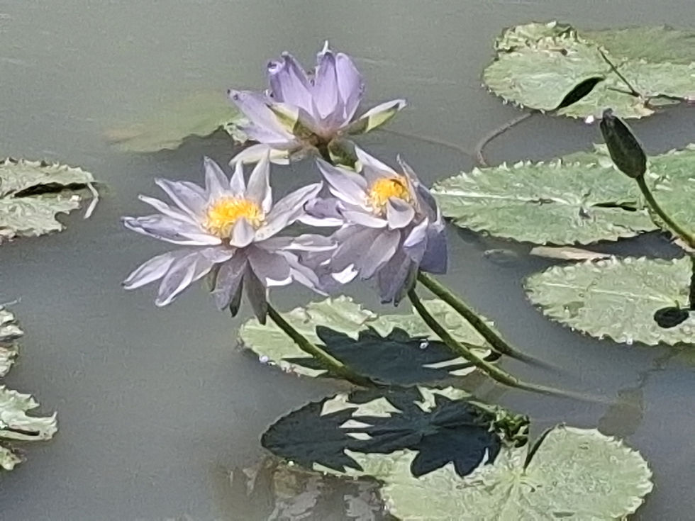
Today was all about chilling beside the billabong to rest up before heading into the Lawn Hill area.
We started the day with a short walk, then did some light cleaning in the morning but, other than that, we just relaxed enjoying the great array of birdlife for the rest of the day.
The day was another hot one, so we moved outside as soon as the sun allowed us some shade, and held off cooking dinner until the temperature started to go down somewhat.
Day 10 - Camooweal, 11 September, 2026
This was planned to be our last day/night at the billabong, but what was that quote about God and men making plans!

As soon as we got out of bed we realised we had an issue with our internal power - all the switch lights in the power cupboard, and the Victron panel, were blank. Weirdly though, when we moved around a bit, the lights would come back on again, then go off again, then come on again....
This behaviour led us to believe there must be a loose wire somewhere, or maybe a short. Based on that theory we removed the dinette seating to gain access to the electrical equipment under there. Our searching and checking of all visible connections didn't help at all, so we were beginning to think there was maybe a loose connection under the vehicle, or that the water pump was somehow causing the issue.
Out of ideas, I called the Explorer factory to talk to Ben, who was busy, but he called back a little while later. After explaining the situation, he was certain that our lithium batteries were out of juice, and that we'd have to connect to 240v power overnight to rectify the situation.
Luckily there were two caravan parks in Camooweal, so we chose the Post Office Hotel Motel caravan park to stay in so we could also have a meal at the pub that night.
So we packed up and drove the short distance into town, emptied the toilet cassette, then parked up behind the hotel and plugged into the power and water, after filling the water tank ready for the next few days.
Apart from doing a load of washing there wasn't much else we could do until the pub started serving meals at 5:30 P.M.
Sitting outside during the afternoon, at one point there was a loud droning noise that we couldn't immediately identify, then we noticed a huge swarm of bees passing through the campground.
Day 11 - Camooweal - Riversleigh, 12 September, 2026
Having been plugged into the power all the previous day and all night, our power was up to 100%. We were a little concerned though that the Victron display wasn't accurate, or that perhaps there was an issue with the solar input. Not much we could do about it though except carry on and see what happens.
This was the first day of this trip that we would be going into uncharted territory, in that we hadn't been to these places before.
We had some concerns about road conditions too, so we were up and about a bit earlier than usual and on the road by 8:30 A.M.
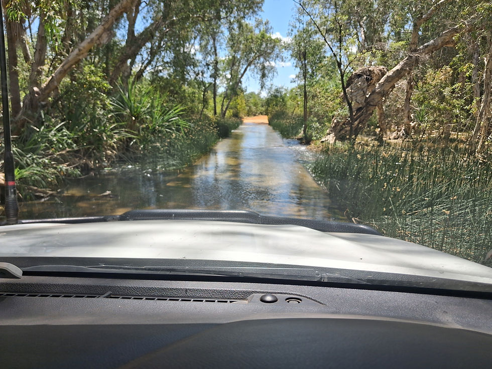
Leaving Camooweal we turned off onto the Gregory Downs Camooweal Road, which was unsealed, but in quite good condition, so we were able to travel at 70 km/h for the most part.
We eventually turned off that road onto another road that was initially sealed, but that didn't last for long and the road deteriorated into badly corrugated unsealed road, that slowed us down to 20 km/h at times. There were thankfully some sections that were sealed giving us some reprieve from the bone-rattling shaking for short periods.
The next road we came onto, towards Riversleigh, was also unsealed but in good condition, which allowed us to make better time.

Pulling up at the Australian Fossil Mammal Site car park, we had lunch then went to explore the fossil centre. Not far from the carpark there was an undercover area that had information boards on the history of the area, and the many mammals that used to live there millions of years ago when it was a large shallow lake.
This is the most prolific site for fossils in Australia and paleontologists have been digging in the area for decades. They've found the presence of many weird and wonderful mammals including a huge Dodo-like bird that stood 3.5 metres tall, huge crocodiles and even a tree-climbing crocodile.

With all that information on board we set out on the 800-metre round-trip walk that goes around behind the information area, and the first half of which was up a steep hill, with the temperature sitting on 32 degrees! It was slow going but, once up at the top, the view of the surrounding area was spectacular. Along the path up to the hill we saw many fossils in rocks lining the path.
With the touristing done for the day we drove back a few kilometres to the Miyumba Bush Camp, which was a national park campsite. Technically we weren't supposed to be there until the following day, so we crossed fingers that the 6-site camp wouldn't be full and that we wouldn't have to move.
Once again the temperature was close to mid-thirties, which meant sitting outside and hoping the almost non-existent breeze would pick up a bit.
It was still hot after dinner, so we sat outside for ages to cool down and watch the amazing star show in a light-pollution free area.
Day 12 - Riversleigh - Adels Grove Campground, 13 September, 2026

With only about 60 km to drive today, to Boodjamulla, we were in no hurry to leave our quiet little campsite, being the only ones there.
We had pre-booked three nights at the Boodjamulla campground, but the booking wasn't actually for another three days, on the Tuesday, this being Sunday. Our plan was to drive there and check out how busy it was, and whether we could stay there earlier than our booked days.
The unsealed road was in good condition and the only thing that slowed us down were a few river crossings, which weren't too deep thankfully.

Arriving at the Boodjamulla campground we could immediately see that we were most likely going to have to change our plans. Of the fourteen available campsites, we could only see three that were vacant, which could well be booked by people who hadn't arrived yet.
There was no ranger on duty, so we made the decision to carry on up to Adels Grove campground, about 11 km away and which wasn't a national park, so we could have any available sites for $40 per night.

At Adels Grove the office was locked when we first got there, so we loitered in the shade of the verandah waiting for a staff member to return. One of the returning staff members caught our attention as she was holding a very young Emu chick that had been rescued.
Eventually the office staff came back and we booked in for two nights. We had the choice of shady sites in "The Grove" or full sun sites in the solar area. Wanting a bit of both we setup in the grove first, on a site that had some sunlight and some shade. However, after setting up we realised that there probably wouldn't be enough sunlight for the solar panels on that site, and also we didn't have a clear view of the sky to the south for the Starlink to give us any internet.

After doing a quick pack up, we moved to another site that had more sunlight, and where the Starlink had a better view of the sky.
After lunch we walked along to where there was access to get into the Lawn Hill Creek, and had a swim in the beautiful cool water. Across from where we were swimming, on the opposite bank of the creek, there was a huge pile of fallen trees that had washed up there during the floods in 2022.
The rest of the day was spent relaxing.
While sitting outside enjoying the dappled shade and breeze, we were amused by the antics of a group of Bower Birds nearby. One was studiously attempting to build his bower (bachelor pad) while performing mating dances to attract any females around the area, while at the same time protecting his bower from other, I assume lazy Bower Birds, who wanted to move into his bower.
Mentioning dappled shade, we realised during the afternoon that we wouldn't be getting enough sunlight to fully charge the batteries, and so we decided we would have to move to a sunnier site the next day.
Day 13 - Adels Grove Campground, 14 September, 2026

Today was mostly about relaxing while waiting until we could get into the Boodjamulla campground the next day.
After a quick cuppa, we did a partial pack up then drove a short distance to another site that had full sun for the whole day, which unfortunately also meant we wouldn't get any shade until later in the morning.
Once parked up we put on shoes then went looking for the start of the lookout walking track.

Having found that we had a fairly easy walk up to a high point overlooking the campground and the surrounding areas. Some of the rock formations in the distance reminded us of similar formations in WA a couple of years earlier.
The views were quite nice at the summit, but not spectacular. We chatted to another couple up there for a while before returning back to our new campsite. On the way back we were lucky enough to spot a small flock of Crimson Finches flitting around the trees.

We got setup for our last night at Adels Grove, then went for a swim before lunch to cool off, seeing our new site didn't have any shade at all.
After lunch we chilled for a while before getting overheated again, so went for another swim to lower the body temperature somewhat.
We'd decided earlier to eat at the campground's Emu Restaurant tonight, which started serving at 5:30 P.M., to avoid having to cook and heat up Mata more than necessary.

Half and hour before dinner started serving we went up to the bar for a couple of drinks to make the most of their happy hour. Even with happy hour, two drinks cost over $17!
We ended up sharing a table with the couple we'd chatted to up the lookout that morning. When dinner arrived we attempted to eat it at the outside table we sitting at, but the flies got so bad we had to save the dinner until later when we got back to Mata.
Day 14 - Adels Grove Campground - Boodjamulla Campground, 15 September, 2026
Upon getting up this morning I did my usual during the morning routine and checked the house power level, which was sitting at 59%, which I was quite pleased with knowing we could get back to close to 100% during the day.
All we had to achieve for the day was to drive the 11 km back to Boodjamulla Campground, find a nice sunny site to charge up the batteries, check out the campground and relax some more.

While having our morning cuppa the internet dropped out - not unusual so we put it down to a Starlink issue. A couple of minutes later, after the internet came back on, I checked the Victron app to see if we were getting any input from the solar panels yet, and saw that the power percentage was on 100%, which I knew it wasn't.
This seemed to imply that the house power had been cut for a short period of time, which reset the Victron power percentage to 100%.
I put a call in to the Explorer factory to talk to Ben, who would hopefully have some idea of what was going on. Not having heard from him an hour later we decided to drive to Boodjamulla and get setup for a two-night stay.
At Boodjamulla we found a nice sunny site that also had a good view of the southern sky for the Starlink, got setup, then had morning tea as we'd missed out on brekky with all the power dramas.
After smoko we went for a walk to the ranger station to see if there were any better maps of the area than the one we had. That drew a blank so we checked out one of the access points to Lawn Hill Creek, which was also the boat ramp where the tourist cruises leave from, on the way back to Mata.

Ben eventually called just before lunch and gave me a couple of ideas on where to look for potential loose connections that may have caused the power blip earlier on. He also said that the only way to recalibrate the Victron power percentage to show the actual value, was to plug in to 240v overnight, then reset the Victron display in the switch cupboard.
So, we had lunch then pulled up the dinette seating to get access to all the electrical components beneath the seats. We checked a couple of wires that Ben said might be suspects, but found nothing out of order.
After replacing the seating we were all hot and bothered, so we wandered down to the other access point to the creek, past the rangers station, where you can also hire canoes.
A person we spoke to at Adels Grove said that Adels Grove is much nicer than Boodjamulla, and they were right. Whereas at Adels Grove there were metal steps into the creek at a deep point, at Boodjamulla it was shallow, rocky and slimy underfoot. We hobbled across the rocks to get into deeper water, but at best is was only about waist height.
We stayed in long enough to cool off before hobbling out again and heading back to Mata for the afternoon.
Sitting outside we enjoyed seeing Rainbow Bee Eaters that, while quite small, were incredibly colourful, as their name suggests.
Day 15 - Boodjamulla Campground, 16 September, 2026

Our main mission for the day was to do the Indarri Falls and Duwadarri Lookout walk.
The walk is about 3 km and requires climbing up hills, so we wanted to be up and about early and do the walk before it got too hot.
We limited ourselves to one cuppa, put on shoes and hats, grabbed the water and set out on the walk by 7:30 A.M.
The first part of the walk was easy, passing through light bush, with a rocky path underfoot. Further into towards the falls, the lower path to the creek where you can see the falls and have a swim was still closed after the 2022 floods.

We continued on climbing up the hill until got to the top of that section, where we had a great view of the Indarri Falls, Lawn Hill Creek and the surrounding rock formations, which were mostly covered in thick vegetation.
Continuing on the round-trip walk we went through a flat section that was covered in Spinifex grass, and where there were some beautiful Grevilleas in various stages of flowering.

After the flat section we had to do some more climbing, this time more radical, up a steep, rocky, narrow path until we came to the Duwadarri Lookout, where we had spectacular views of the creek looking back towards Boodjamulla camp and Adels Grove.
Then we had to do an impression of a mountain goat to get back down to ground level on the very steep path, taking every step very carefully.
We mostly spent the rest of the day recovering from that extreme exercise, although I did go for a swim in the creek after lunch, this time at the closer access point where the cruise boat is moored.
Day 16 - Boodjamulla - Leichardt Falls Free Camp, 17 September, 2026

It was time to leave the beautiful area of Boodjamulla and start heading towards Kurumba, with a one-night stopover at Leichardt Falls along the way.
We had a 230 km drive to get to Leichardt Falls on uncertain roads, so we left camp a little earlier than we normally would.
The first part of the drive, about 100 km, was to the small town of Gregory. The roads were reasonable for that section, but it still took us about two hours to get there.
Meg spotted a bunch of Emus along there and our first Bustard (Plains Turkey) of the trip.
In Gregory we emptied the toilet cassette and filled up our fresh water, before continuing on north-east towards Leichardt Falls.
The next part of the drive was on the Wills Developmental Road, which once again was in reasonable condition, but then when we turned onto the Burketown Road, we hit a section of badly corrugated road that slowed us right down to under 30 km/h at times.

Fortunately that only continued for the first 15 km, then the corrugations mostly eased so we could travel at up to 70k km/h for the rest of the journey.
The dust was horrific for most of the day's drive, even to the extent that at one point there was so much dust inside that it set off the smoke detector.
We crossed the Leichardt River then turned off and found a campsite on the banks of the river for the night.
After setting up and having a piecemeal lunch (we were starting to run low on supplies by this stage) we walked along the banks of the river past the just running waterfall, until we found a spot in the river where we could have a dip and cool off from the mid-thirties temperature.
We chilled for the rest of the day at our quiet campsite.
Day 17 - Leichardt Falls Free Camp - Karumba, 18 September, 2026
We had a 225 km drive today, which would once again be on unknown road conditions.
Leaving Leichardt Falls and getting out onto the road was a challenge in itself, with a windy, hilly sand track that was washed out in places and with lots of potholes and rough patches.
Turning onto the Normanton road we immediately hit bad corrugations that kept our speed down to between 20 - 50 km/h. That continued on for the first 50 km when the corrugations mostly disappeared, but it had taken the best part of two hours to cover that distance. After a while the road turned to bitumen, so we made better time from there on.

We got into Normanton, which was about 150 km from Leichardt, near lunchtime, which meant it had taken us three hours to cover that distance.
The first port of call was the servo, where we pumped nearly 100 litres of diesel in, at $2.73 per litre. Next up was a visit to the supermarket to fill up our nearly empty fridge/freezer and cupboards. $250 later, we popped into the bakery next door to grab a couple of filled rolls for lunch, then found a slightly shady spot to park up, put all the groceries away and to eat our rolls. Last port of call in town was the bottle shop to replenish our almost non-existent booze supplies.
Then, it was an easy 75 km drive to Karumba on sealed roads. On that stretch of road we saw hundreds of Brolgas lining the sides of the road, wherever there was any water source.
We booked into the Karumba Point Sunset Campground for two nights on a powered site, got organised then went for a swim in the pool, which was a bit bitey when first getting in.
We had asked for a shady site when booking in, and arriving at the site it seemed not too bad, but it didn't take long to realise that we wouldn't have any shade from the setting sun, and so had to move around a bit so as not to be sitting in the sun in 35 degrees.
Day 18 - Karumba, 19 September, 2026

Today was planned as a chill day, with a bit of cleaning thrown in.
After managing a sleep-in, despite our noisy neighbours, and having breakfast, the first item on the agenda was putting a load of washing on in the laundry.
Then we set about cleaning the layers of dust out of the cab, that had been pouring in while driving on all the unsealed roads recently.
More cleaning followed outside and inside Mata until the worst of the surface dust was removed. The rest would have to wait until we got home to do a more thorough clean.

Now that we would be driving on mostly sealed roads again, we also reinflated the tyres back to their normal levels.
After all that activity, it was time to relax for the rest of the day, until it was time to go to the sunset bar for a drink and dinner later in the afternoon.
We did take the opportunity to have a swim after lunch, when all the other people were having their lunch, and we enjoyed being the only ones in there.
A bit after five o'clock we walked over to the Sunset Bar, had a drink while we perused the menu, ordered and ate dinner and enjoyed the amazing sunset.
Day 19 - Karumba - Croydon, 20 September, 2026

Today's mission was a 225 km drive to Croydon.
Setting out reasonably early, we first drove into Karumba township to check it out as a potential place to stay on any subsequent visits we make to the area.
It didn't look very nice so we carried on the drive back into Normanton. Not far out of Karumba we spotted a Dingo walking across a paddock, then further along we saw more of the Brolgas we'd seen driving into Karumba, some Pelicans and Egrets and a lone Jabiru.

In Normanton we stopped off at the train station/museum. Unfortunately the museum was closed but we were able to walk around the buildings and see the Gulflander train, that runs tourist trips between Normanton and Croydon.
The rest of the drive to Croydon was mostly boring on long, flat, straight roads with not much traffic and a total lack of wildlife except for raptors eating roadkill.
On the outskirts of Croydon we turned off up to Diehm's Lookout for a view of the small town and the flat landscape behind town.
Just before entering town we stopped at a Chinese Temple Memorial, honouring the many Chinese people who lived there during the gold rush years, where the remains of a temple still exist.
In town we pulled into the caravan park and booked an unpowered site for one night.
After setting up and having lunch we set out to see some of the town's history.

First stop was the visitor information centre, which had a lot history display boards documenting the life of the town, particularly relating to the gold rush years that ran from the mid-1880s to the 1920s. We also checked out the garden behind the centre that had some old buildings to look through.
With map in hand we set out on the town's heritage walk, which took us through some of the old original buildings, like the sergeant's house, jail, courthouse and community hall. All the buildings were crammed with more information boards that took us through the early history of the town, the arrival of the railway and more on the gold rush.
We didn't look at all the buildings on the trail because it was early afternoon and very hot, so we wandered back to camp to chill for the rest of the day.
Day 20 - Croydon - Talaroo Free Camp, 21 September, 2026

Today's simple plan was to drive 240 km to Mt Surprise and stay a night in a campground there.
The drive was another boring one, with hardly any wildlife to watch apart from a couple of Brolgas, cattle, Kites and roadkill.
Needing a leg stretch and rest stop, we pulled up at the Gilbert River and walked a short distance along a sandy track to the river, which was almost dried up.
We stopped next in Georgetown to pick up a couple of things, then continued on towards Mt Surprise.

The scenery became a little more interesting as the road took us over and around some hills, some of which were called The Sisters.
During that part of the drive we decided we didn't want to pay to stay in another campground, so checked out some possible free camps. The first couple didn't appeal, but we did find a large gravel pit/quarry/council depot that was deserted, a little way off the main road.
It was about lunchtime so we had lunch after setting up, then relaxed outside for the afternoon.
Day 21 - Talaroo - Paronella Park, Mena Creek, 22 September, 2026
We had another drive lined up today, 290 km, that would take us to Paronella Park in Mena Creek, north of Tully.
The drive started out like the previous few days, taking us through boring farmland, and some national park, seeing only cattle, birds and roadkill again.
After a couple of hours we came to Mt Garnet, where we stopped briefly for a leg stretch, rest stop and to buy a couple of items from the servo supermarket.

Continuing on the drive we came to a point where we could take a lesser road to get off the highway, so we chose to do that. To be fair, there was an electronic trailer sign not far up that road that said there was a bridge closure that started today, but we thought "no, that can't be right" and carried on.
The road was narrow, windy and hilly, and took us over mountainous territory. The contrast in landscape couldn't have been more pronounced, after driving for the last few weeks through dry, barren landscapes. Now we were driving through lush tropical rainforest that seemed as though it would take over if left to its own devices for a short period of time.

Passing through a particularly narrow and dense vegetation area, we were lucky enough to have a Cassowary cross the road slowly in front of us. Not so slow though for us to get a photo before it disappeared into the thick bush on the other side of the road.
After about half an hour, and about three kilometres away from coming out onto the highway, we came to the bridge that was closed, with a workmen manning barriers across the road.
There was nothing else we could do but turn around and go most of the way back to where we'd come from. We took a side road back towards the highway that took us past the Windy Hill Wind Farm, where we considered stopping for lunch but it didn't look very savoury.

So we carried on into Millaa Millaa where we stopped for lunch, then continued on for another 70 km to Paronella Park.
At the park we checked in for a night, signed up for the night tour of the park, then got setup and attended to our usual tasks.
After an early dinner we went up to the reception area for the evening tour of the park and to learn how it all came about. Click here for a brief history of Paronella Park.

We learnt that the park had been the brainchild of Jose Paronella, a Spaniard who had intially spent about 12 years in North QLD, making money as a cane cutter. After returning to Spain to marry his fiance, he discovered that she had married someone else, so he ended up marrying her sister, taking her back to Mene Creek, then setting about creating Paronella Park.
One of the more impressive feats of this project, for the early 1930s, was that Jose built a hydro-electric power plant to supply power to the whole park, and that plant is still supplying power to the park over ninety years later.
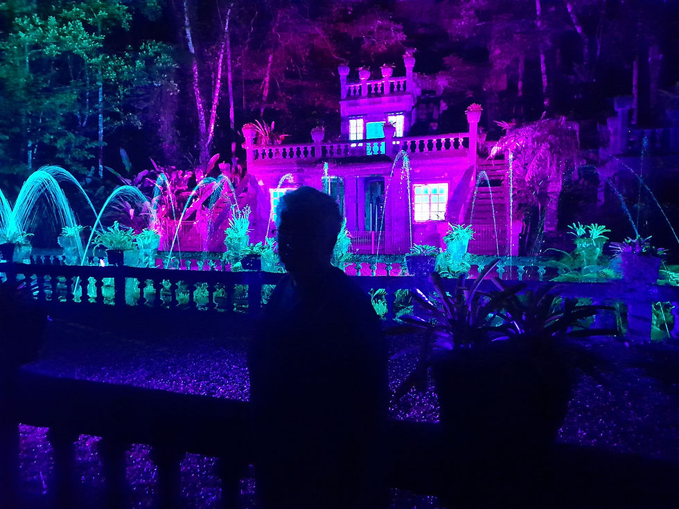
Our guide took us around parts of the park, explaining how some of the facilities came about, like the twin tennis courts, ballroom complete with glitter ball and movie theatre, picnic areas, fountains, waterfalls, Kauri tree plantation etc.
The tour culminated with a light and sound show on one of the larger buildings, where there fountains lit up by multi-coloured lights and where there also used to be a full band playing music back in the thirties.
Day 22 - Paronella Park - Bilyana Free Camp, 23 September, 2026

During the night we were woken by the first rain that we'd encountered for around three weeks, and the rain kept falling intermittently through the morning.
Although we had done the night tour of Paronella Park the previous night, we also wanted to do the day tour to see as much of this amazing place as possible.
The first tour for the day kicked off at 9:30 A.M., so went back to the reception area where the tour started from, along with two other couples.

Once again the tour guide gave us background on Jose Paronella and how he came to create Paronella Park.
We did double up on some of the things we'd seen the night before, but we also experienced a bit more detail on some of those things, like how the sand that Jose used to make the concrete for the buildings and other structures like bridges, had too much mica in it, and this caused concrete cancer. The ballroom now only consists of what would have been supporting some posts and the structure that houses the glitter ball.

We also learnt that Jose had planted 7,500 tropical plants, which is now a rainforest, and that homemade ice cream was very popular when any events took place like balls and movie nights.
At the end of the tour, near the Kauri plantation, we were left to our own devices and we went first to a large pond area where there were plenty of fish and turtles for us to feed with the food we'd been given before the tour started.
A short distance away from there we went to Teresa's Falls, a small waterfall that fed into a small stream with little bridges crossing it occasionally.

Going back towards the reception area we went into the museum to learn more about the history of the park, including as we'd been told by the tour guides, about several floods and a couple of cyclones the park had experienced over the decades. The 1946 flood had been particularly bad and wiped out a lot of infrastructure.
Having exhausted all that the park had to offer, we stopped off at the cafe for a smoothie and sticky bun, before heading off towards Tully.

We wanted to check out some of the coast before hitting the Bruce Highway so, when we came to the intersection with the highway, we crossed over and drove to Kurrimine Beach, a small town that had three caravan parks, but they were all quite expensive, so we headed back out to the highway and into Tully.
On that last part of the drive the fuel light had come on, which meant it was time to fill up with diesel. I pumped in almost 130 litres of fuel, at $2.78 per litre, so it hurt when I had to cough up around $360 to fill the tank.
It was around lunchtime by then, and we decided we didn't want to drive too much more for the day, so we found a rest stop free camp just off the highway, about 20 km south of Tully.
It was a bit rough, but would do us for a free night.
Day 23 - Bilyana Free Camp - Balgal Beach, 24 September, 2026
As with the previous night, we were woken during the night by quite heavy rain, which persisted through the morning.

With only 160 km to drive today, we were in no hurry with our morning routine. However, when the rain became heavier, and we checked the BOM radar, we decided to get moving because it looked like the rain wouldn't be as bad further south.
Just south of Cardwell, at the Hinchinbrook Island ferry area, we stopped to empty the toilet cassette, before continuing our journey south on the Bruce Highway.
Passing through Ingham we popped into Woolies for a few things, then it was back onto the Bruce until the turn off to Balgal Beach, where we headed toward the Mystic Sands golf club, our campsite for the night.

We checked in and got sorted for a night's stay on a $20 unpowered site for the night, then had an early lunch.
The light rain had been a bit on and off since our arrival at Mystic Sands, but after lunch it seemed to be mostly over for now, so we went up to the clubhouse and paid for nine holes of golf and a push buggy.
Thankfully the rain held off for us, and the golf wasn't too bad, so we enjoyed the three kilometre walk around the course.
Back at camp we caught up with our online bits and pieces, while chilling for the remainder of the day.
Later in the afternoon we went up to the clubhouse for some wine and buffalo wings, which were yummy because we hadn't had any for a long time.
Back at camp, we had dinner and, while cleaning up, the water pump suddenly stopped working. We didn't have the mental resources to deal with the issue by that time, and decided to work out our approach in the morning.
Day 24 - Balgal Beach - Flat Rock Free Camp, 25 September, 2026
Going to bed with a quite serious issue pending isn't a good recipe for a good sleep!

We slept fitfully and got up early to try and decide how we were going to go about getting the water pump fixed, which probably meant a trip into Townsville to a caravan repair place.
While going through the morning routine I remembered that we'd had the same issue a few years back, and I'd called Ben at Explorer at that time to see if he could help us. His advice was to climb under the vehicle, locate the water pump, see if the filter needed cleaning and, if all else fails, give the solenoid on the pump a whack with a heavy object. It was the whack that fixed the issue in that case, until we could get the pump replaced.

So, climbing under Mata, I removed the filter assembly and the pump starting running again. After Meg cleaned out the filter and I replaced it, the pump was back to normal operation, which we were very pleased about.
After filling up with fresh water, we began the day's 200 km drive to the Flat Rock free camp, about 20 km east of Charters Towers.
The drive was unremarkable, firstly on the Bruce Highway, where we stopped off to empty the toilet cassette, then onto the Charters Towers road, which was quite busy.

We went into Charters Towers to stock up on wet supplies, than drove 20 km back east on a back road to get to the Flat Rock free camp, on the banks of the Burdekin River.
We found a reasonably level campsite, had a wander down to the river, had lunch then enjoyed the setting for the remainder of the day.
Unfortunately, during the afternoon, a strong gusty wind came up, getting to the point where it drove us inside to escape the clouds of dust it was raising, also scotching our hopes of having our first campfire of this trip.
Thankfully, however, the wind abated by late afternoon, and we moved into a bit of a Goldilocks zone for having a campfire, with light winds, cooler temperatures and no rain in sight. We dragged out the campfire equipment and got a good fire going while we made dinner and, for a change, sat outside by the fire to have our dinner.
Day 25 - Flat Rock Free Camp - Llanarth Free Camp, 26 September, 2026

Not completely sure where we would end up tonight, but not expecting to drive too far, we weren't in a hurry to leave our riverside free camp.
However, after a good night's sleep, we awoke early, took our time with our usual routine, but were still on the road by 8 o'clock.
We drove back into Charters Towers to make use of their dump point, then started driving south towards Llanarth.
The drive was another extremely boring one, passing through farmland and seeing only a few cattle and birds. There was a light amount of other traffic on the road, which was not enough to bother us or prevent us from pottering along at 80 km/h to conserve fuel.

One possibility for a free camp for the night was the site of a large Telstra tower where there was a large area for camping well off the main road, lots of firewood lying around, and maybe nobody else around. This option would mean being at the camping area before lunch, so a long afternoon.
Another option was at Lake Buchanan, a further 90 km away from the first option.
We decided to check out option one first, which took us off the main road and onto a badly corrugated unsealed road. It was five kilometres to the Telstra tower camping area and, if we wanted to carry on to Lake Buchanan, that would mean another 90 km of badly corrugated road. Guess which option we chose?

The Telstra tower camping area was huge and deserted. We took our time in choosing our camping spot, oriented as always to the south for shade and, when necessary for the Starlink. Though considering we were parked up in the shadow of a big-arse Telstra tower, we wouldn't be needing the Starlink.
After setting up I went on a firewood-hunting expedition to prepare for the evening's campfire, then we had lunch and, because there was nothing else to do, we relaxed outside for the rest of the day.
Late in the afternoon we cranked up the fire and enjoyed the ambience until dark.
Day 26 - Llanarth Free Camp - Elphinstone, 27 September, 2026
Our plan for the day wasn't firm in that we had a few options for where we might camp for the night.
During the morning routine the water pump suddenly stopped working again, so we decided to leave it until we pull up for the day, in the hope that some driving on rough roads might kickstart it again.
Our first destination for the day was Belyando Crossing, an easy drive on sealed roads. We had a rest stop there before deciding we didn't want to stay there because it was way too early in the day, and it didn't look that savoury anyway.
Heading out of Belyando Crossing we soon hit badly corrugated unsealed road that forced us to slow right down to as low as 20 km/h in places. That continued for the first 20 km, then thankfully improved to allow travel at up to 70 km/h, until we arrived in Mt Coloon.

Mt Coloon was another potential stopping point for the night, across the road from the pub. We went into the pub for a drink and to work out if we would stay there, and maybe even have lunch. By the time we'd finished our drinks it was only 11:30 A.M., and lunch didn't start serving until midday, so we decided to keep moving to the next place we could stay the night.
A few kilometres along the road, which was also unsealed but in reasonable condition, we stopped at a quarry for lunch.

Continuing on we set our sights on the free camp at Lake Elphinstone, about 80 km further along the unsealed road.
On the outskirts of Elphinstone we stopped briefly to take photo of a large abandoned excavator, then carried on to the lake, where we eventually found an acceptable campsite for the night, alongside dozens of other holidaying families making the most of the school holidays.
After setting up we dealt with the water pump, cleaning the filter again, then whacking the solenoid to get it going again. Thankfully it started pumping again, but it didn't sound very healthy.
And that was is it for another day of touristing.
Day 27 - Elphinstone - Capella, 28 September, 2026
Today was going to be a bigger driving day than most recently, 300 km to Capella.
But first, that pesky water pump, which refused to work again this morning, prompting a bashing of the solenoid with a wooden spoon until it started pumping again.
We'd read some very good reviews for Gem Plumbing in Emerald, submitted by people who had had their RVs repaired there, including replacing water pumps. As soon as the clock ticked over to 7 o'clock, I called Gem Plumbing and spoke to a very helpful lady who thought they'd be able to replace the pump the following day, on Tuesday. She said she'd call back later in the day to confirm that.
The day was mostly spent travelling along boring roads, past farmland the same as what we'd been seeing for hundreds of kilometres now.
We had a brief stop in Nebo to put a small amount of diesel in, at $2.96 per litre, enough to get us to Clermont where the price of diesel was 20c per litre cheaper.
Our next stop was at Clermont, where we filled up with 213 litres of diesel at $2.76 per litre and parked up beside the servo to have lunch.
To finish off the day's driving, we did another 50 km to Capella, checked in for a night on an unpowered site, put a load of washing on and caught up with our socials.
The lady from Gem Plumbing called back to say that they could replace the pump the next day, so we arranged to be there by 8:30 A.M. to have that done.
Day 28 - Capella - Comet, 29 September, 2026
The main mission for today was to get our water pump replaced in Emerald, before heading off into a remote national park for two nights.
We were up earlier than normal and on the road not long after 8:00 A.M.
Arriving at Gem Plumbing before nine, John checked the water pump, declared it dead and set about replacing it, using a new pump originally destined for another customer, but diverted to us, with John's wife Deb hoping that more pumps would arrive in time for the other customer's job.
I assisted John as much as possible to hurry the job along, including at one point crawling under Mata to hold the new pump in place while John screwed it in. The job wasn't without it's issues, but John was old school and nothing would prevent him from doing a great job.
The pump replacement ended up taking longer than expected, but was still complete and up and running two hours later.

After forking out $545 for the job we headed out of Emerald, but stopping first at Woolies for a few bits and pieces to keep us going until we got home in a few days.
Then it was a short drive to Comet where we pulled up at the hotel, checked in on an unpowered site for the night, got set up and went into the pub for a drink and lunch.
Feeling replete after a big lunch it was all we could manage to sit outside for the afternoon and chill.
Day 29 - Comet - Blackdown Tableland NP, 30 September, 2026
Today we were heading into the Blackdown Tablelands NP, a 100 km drive away on uncertain roads.

Leaving camp a little earlier than normal because of the unknown road conditions in front of us, we drove first to Blackwater where we stopped briefly to empty the toilet cassette, then continued on towards the tablelands, stopping only to buy some firewood from a roadside stall on the way.
Our first stop inside the national park was at the Gudda Gumoo (Horseshoe) lookout that gave us a good 180 degree look around the surrounding countryside.
Next to the lookout was a 3.6 km return walk through bushland, to the Two Mile Creek waterfall, which we decided to undertake as it was still quite early. The walk was pleasant enough, but there wasn’t much creek or waterfalls happening at the end of the track to see, so we headed back the way we’d come.
The last seven kilometres of the road into the Munall camping area was largely unsealed and badly corrugated, slowing us right down to walking pace at times.

At the camp we checked our campsite for the next two nights, discovering that it was nowhere near level! We though we could make it work well enough though using the levelling ramps.
By then it was getting close to lunchtime so we decided to continue the 8 km drive out to the end of the road to Gudda Gumoo (Rainbow) falls walk. The road was really bad, starting with bad corrugations then deteriorating into big potholes and washouts. It took about 25 minutes to cover the 8 km.
Arriving at the falls, the car park was chockers so we had to park up on the side of the road before the park to have lunch.

With lunch out of the way we donned shoes and hats and set out on the 3.6 km return walk to the falls, which was mostly downhill. At the end of the track there was a sign saying that, going left, there were 240 steps down to the rock pool at the bottom of the falls. Not really knowing the layout of the area we went down the steps to the pool for a view of the trickling waterfall. As it turned out, we could have turned right at the sign and avoided going down all those steps.
We took some photos and had a rest before setting out on the return journey, and were absolutely stuffed by the time we got back to the car park.
We suffered the return 8 km journey on the bad road to the camping area, got setup as level as we were able to, then attended to our usual afternoon chores.
Being high up on a mountain, the temperature cooled down quickly as the sun started to drop, making it the perfect time to get a good fire going to keep us warm.
Day 30 - Blackdown Tableland NP, 01 October, 2026

We woke to a much cooler morning than we’d been used to in past few weeks, and there was quite a strong wind blowing too.
Our plan for the day was to do the walks around the campsite that included a 2.5 km circuit walk, a 2.5 km return walk, and a short walk from our campsite to an area where the local Ghungalu people have a dancing area and bush theatre.
After brekky we got rugged up with warmer clothes then set out to do the 2.5 km Goon Goon Dina circuit walk.

The walk was much easier than the one the day before to Rainbow Falls, and was mostly through dense bush with easy steps and moderate climbs. Dotted along the path there were plenty of information boards describing the history of the area, that included some about the early pioneers who attempted to farm cattle here, but mostly the boards documented the lives of the local Ghungalu people and how they interacted with the land and flora and fauna.

The walk followed the path of Mimosa Creek, which did have water in it in places, and eventually brought us to a large rock escarpment where there was a display of Aboriginal rock art. Carrying on we eventually came back out to the campground not far from our campsite.
It was only a short distance from there to the area adjacent to the campground where the Ghungalu people have a bush theatre and large circular dancing area that we checked out.

Back at camp we recovered from the overdose of fresh air and sunshine for the remainder of the morning.
After lunch we set out on the last walk that the area had to offer, the Mook Mook lookout walk, which was a 2.4 km return trip.
While the track was a little more challenging than our morning walk, taking us over rocky, uneven ground at times, it was still a fairly easy walk. Near the start of the track we took the wrong path and ended up on a large rocky area covered in rock pools.

We soon got back on the right path and, crossing another rocky area, we could hear a couple of Pobblebonk frogs communicating with each other.
Eventually we came to the end of the track, where there was a fenced-off area with views overlooking the Mimosa Gorge and across to the Dawson Ranges.
On the way back we stopped to investigate the Pobblebonk frogs. They were in a large rock pool and Meg got a glimpse of one as it poked its head out from under a rock ledge, but then quickly retreated on seeing someone there.
With all the touristy stuff done in the park we had a well-earned rest for the remainder of the day.
Day 31 - Blackdown Tableland NP - Calliope, 02 October, 2026
Winding down on the second last day of this adventure, we planned to drive around 300 km south east to Calliope, with much of driving on highways unfortunately.
First though, after leaving camp a bit earlier than usual, we had to get down off the tablelands. We knew the first 8 km of mostly unsealed road was horrible, and it still was! It was early though so we were able to take our time with that rough section of road.

Back on the sealed road, we started the long, steep descent down to the base of the tablelands. It was slow going along the narrow, steep, windy road and after a while the brakes started to protest. Back down on level road, we pulled over on the side of the road to empty our grey water tank, and discovered that the front brakes were emitting smoke from being overheated. That led us to drive more slowly for a while to get some air flow around the brakes while avoiding braking as much as possible.
Coming out onto the Capricorn highway we carried on until we reached Duaringa, where we stopped briefly to empty the toilet cassette, before continuing on to Westwood where we had a rest stop and reinflated the tyres back to their normal level, before we hit the Bruce Highway and would have to drive faster than our usual 80 km/h.
Then it was a boring drive down the Bruce Highway to the Calliope River free camp. We found a nice level spot looking over the river, set up, had lunch and chilled for the afternoon.
Day 32 - Calliope - Home, 03 October, 2026
For the last day of this adventure we had a 250 km drive down the Bruce Highway to home, stopping only in Miriam Vale for a rest stop and to empty the toilet cassette.
Arriving home around lunchtime we grabbed a pie from the Howard Bakery, then started the big cleanup.
Over the last 32 days we covered 4,500 km.


Comments